Delta Tunnel
What Is The Delta Tunnel?
The Delta Tunnel project is the latest version of a massive water infrastructure project that would divert water from the Sacramento River at Hood and Courtland, and put it in a 40+ mile tunnel 40 feet access to be exported to State Water Project contractors. Could also be used for wheeling Central Valley Project water.
Other names
- Peripheral Canal (1940's to 1982)
- Bay Delta Conservation Plan (2008-2014)
- Californias Water Fix (2015-2019)
- Delta Conveyance (current)
Why Is The Tunnel So Damaging?
- Delta Tunnel Myths and Facts
- National Environmental Policy Act Review of Delta Conveyance Project is Incomplete and Inadequate
- The Delta Tunnel Proponents Exaggerate Earthquake Risks and Divert Attention from Flood Control Needs to Protect Delta Communities and Water Supplies
- Delta Tunnel Impacts Map
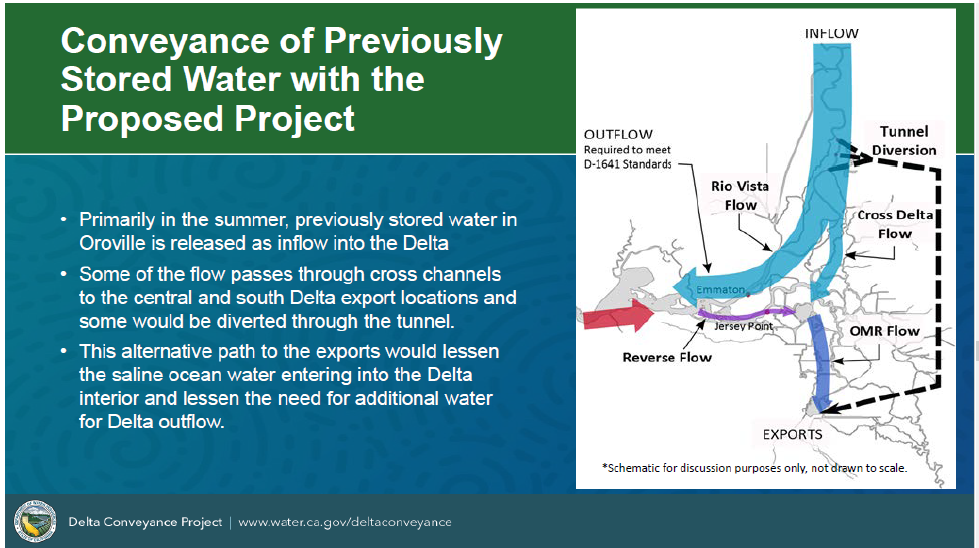
Conveyance of Previously Stored Water with Proposed Project
- Primarily in the summer, previously stored water in the Oroville is released as inflow into the Delta
- Some of the flow passes through cross channels to the central and south Delta export locations and some would be diverted through the tunnel
- This alternative path to the exports would lessen the saline ocean water entering into the Delta interior and lessen the need for additional water for Delta outflow
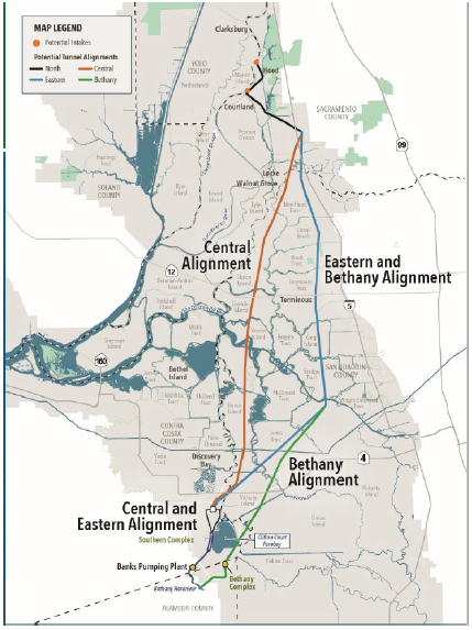
Routes For The Tunnel Being Considered By The CA Department Of Water Resource
Project would include
- Two 3,000 cubic feet per second intakes at Hood and Courtland (each almost 1 mile long)
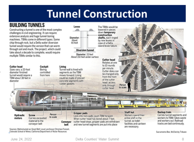
- 40+ miles of 40’ in diameter tunnel buried 150 feet down with shafts
- Southern Complex Facilities: Pump Station, Forebay
- 14 years of construction
- Heavy truck trips on I-5 and local roads (200,000+ truck trips)
Project does not include
- Any local benefits (e.g., water supplies)
Cost
$16 billion +
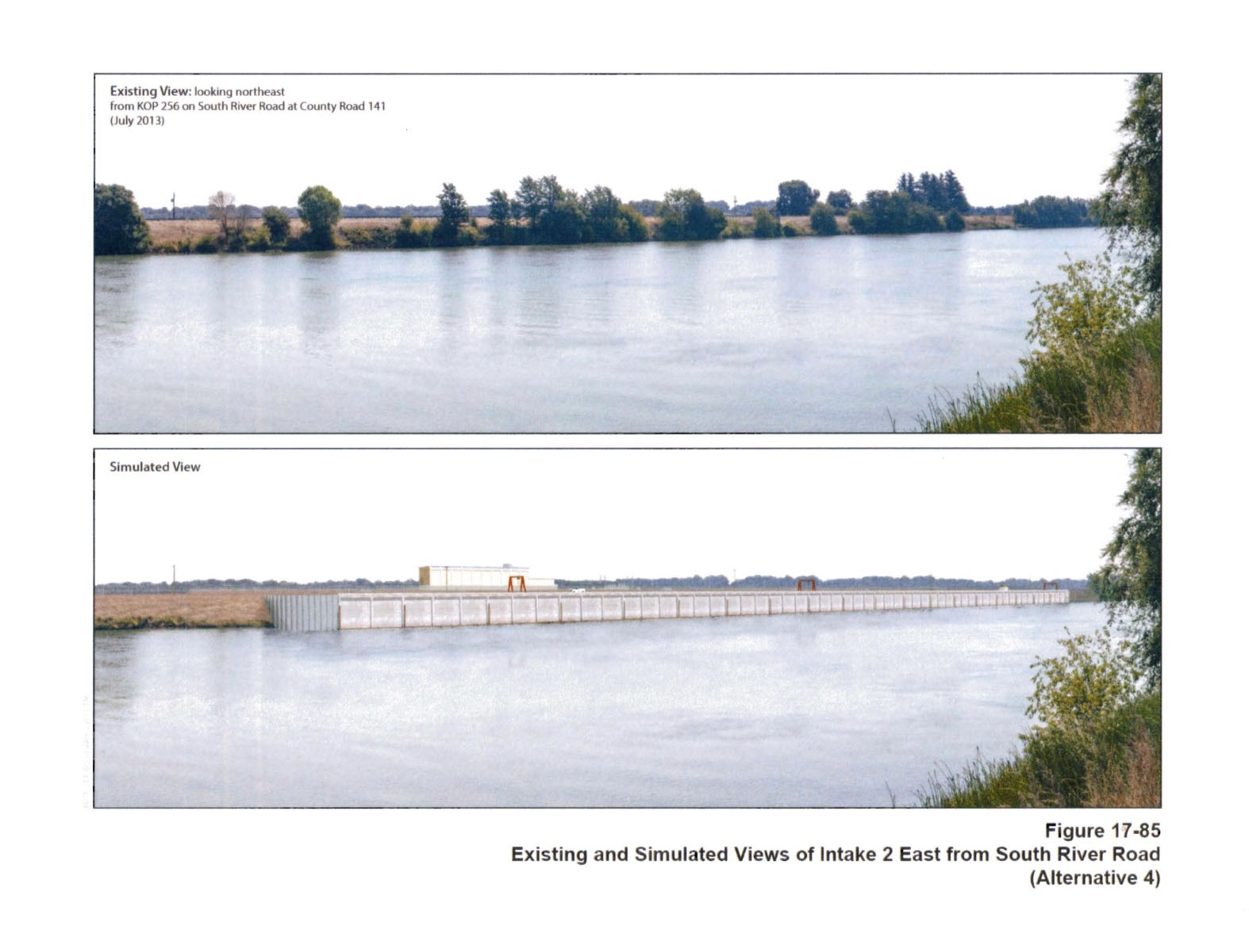
Existing and Simulated Views of Intake 2 East from South River Road. Each screen is over 1,300 feet long - almost 4 football fields.
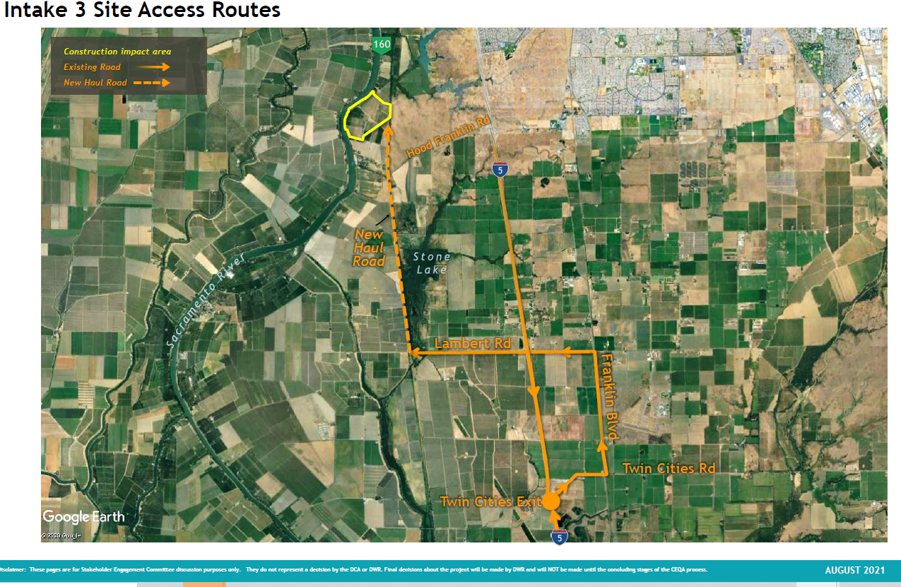
Intake 3 Site Access Routes.
Tunnel Construction
The Delta Conveyance Project Permitting and Review Status is Nowhere Near Done